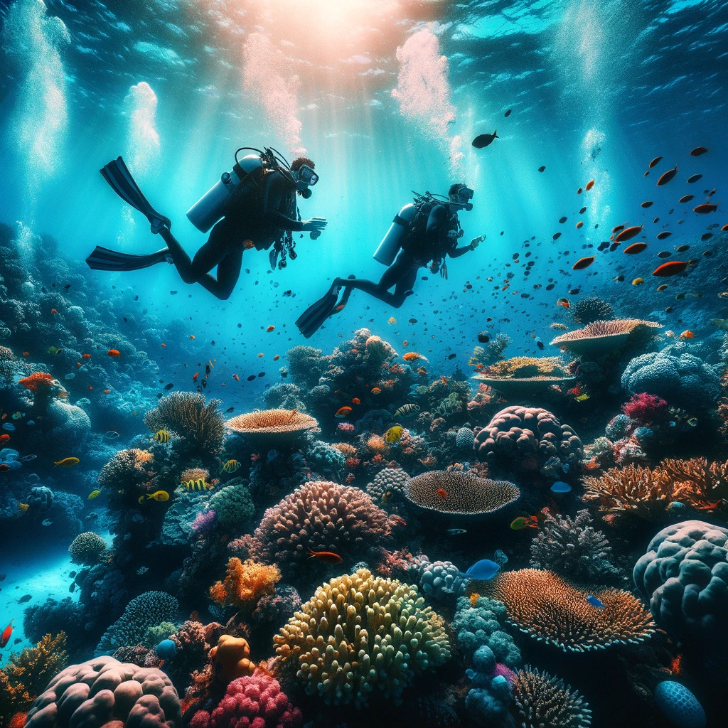
Few places on Earth pack as much ecological diversity, topographical contrast, and adventure potential into a compact geography as Israel. In a country scarcely the size of New Jersey or Wales, an adventurer can start the morning backcountry skiing down the snow-dusted alpine ridges of Mount Hermon, trek across Mediterranean oak forests by midday, descend into the ancient canyons of the hyper-arid Negev by afternoon, and end the evening scuba diving among tropical coral reefs in the warm waters of the Red Sea.
This authoritative intelligence and expedition guide provides a comprehensive overview of nature and outdoor pursuits in Israel. We analyze the iconic 1,000-kilometer Israel National Trail, world-renowned Red Sea marine sports and scuba diving, desert canyoneering and speleology, northern river trekking, avian migration hotspots along the Great Rift Valley, rock climbing crags, Mediterranean windsurfing, sea kayaking at Rosh HaNikra grottoes, astro-tourism dark sky reserves, endurance ultra-marathons, regional long-distance trails, premier mountain biking networks, and essential safety protocols for navigating Israel’s diverse microclimates.
1. The Topographical Miracle: Four Biomes in a Single Day
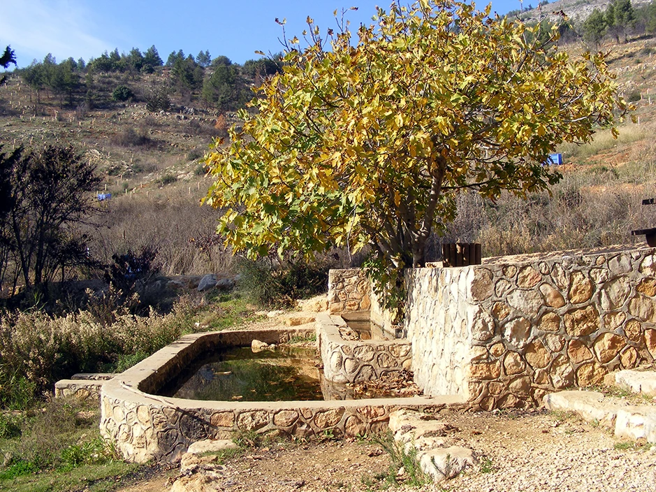
Israel’s unique position at the convergence of three continents—Asia, Africa, and Europe—creates an unmatched density of distinct biographical and climatic zones. Spanning just 470 kilometers from north to south and barely 100 kilometers at its widest point, the country encompasses four major biomes:
- Alpine / Sub-Alpine: The northern Hermon massif (peaking at 2,224 meters above sea level in Israeli territory), characterized by sub-zero winter temperatures, heavy snowpack, and cold-climate karst scrublands.
- Mediterranean Woodland & Maquis: The rolling limestone hills of the Upper and Lower Galilee, Mount Carmel, and the Judean Mountains, covered with evergreen scrub oak (Quercus calliprinos), terebinth, and wild pine.
- Semi-Arid Steppe & Irano-Turanian: The transitional zones of the northern Negev and Judean Desert rainshadow, marked by seasonal wildflower carpets and dwarf shrublands.
- Hyper-Arid Saharo-Arabian Desert: The dramatic landscapes of the southern Negev, Arava Valley, and Dead Sea basin, where annual rainfall frequently drops below 50 mm, producing stark canyons, sandstone arches, and majestic salt formations.
| Geographic Zone | Elevation Range | Dominant Topography & Biome | Signature Outdoor Pursuit |
|---|---|---|---|
| Upper Galilee & Mount Hermon | 800 m to 2,224 m | Alpine limestone, karst sinkholes, perennial mountain streams | Alpine skiing, snowshoeing, river trekking (Dan & Snir) |
| Golan Heights & Sea of Galilee | -210 m to 1,200 m | Basalt volcanic plateaus, deep river gorges, freshwater lake | Canyon jumping, swimming, open-water sailing & kayaking |
| Judean Mountains & Coastal Plain | 0 m to 1,020 m | Mediterranean maquis, coastal sandstone ridges, sandy beaches | Singletrack MTB riding, Mediterranean surfing & coastal hiking |
| Dead Sea & Judean Desert | -430 m to 400 m | Hyper-saline rift lake, salt diapir caves, dry waterfall canyons | Technical canyoneering (dry rappelling), speleology |
| Negev Highlands & Eilat Massif | 0 m to 1,037 m | Erosion cirques (makhteshim), granite peaks, Red Sea coral reefs | Multi-day desert thru-hiking, scuba diving, rock climbing |
2. The Crown Jewel: The Israel National Trail (Shvil Yisrael)
Inaugurated in 1995 by the Society for the Protection of Nature in Israel (SPNI) and inspired by the Appalachian Trail, the Israel National Trail (Shvil Yisrael) is a continuous marked footpath spanning over 1,050 kilometers (650 miles). It stretches from the lush northern border at Kibbutz Dan near Mount Hermon to the southern frontier on the Gulf of Aqaba at Eilat.
Ranked by National Geographic as one of the world’s top 20 epic long-distance trails, the INT is marked throughout its entire length by a distinctive tri-color trail blaze consisting of three horizontal stripes: White (pointing north toward snowy Hermon), Blue (symbolizing the Mediterranean coastline and Sea of Galilee), and Orange (pointing south toward the red sands of the Negev).
Thru-Hiking the INT: Logistics and Strategy
Completing the entire Israel National Trail takes between 45 and 60 days of continuous hiking. Thru-hikers generally choose between two primary seasonal windows to avoid the blistering desert summer heat:
- Southbound (Autumn, October to December): Starting in the cool, green north and walking south into the desert as winter temperatures drop to comfortable daytime trekking levels.
- Northbound (Spring, February to April): Starting in Eilat during late winter and trekking north to catch the vibrant spring wildflower blooms across the Judean Hills and Galilee.
The Cultural Phenomenon of “Trail Angels” (Malachei HaShvil)
One of the most heartwarming cultural institutions along the Israel National Trail is the network of Trail Angels (Malachei HaShvil). Hundreds of Israeli citizens—ranging from kibbutz families and bedouin desert hosts to city dwellers living along the trail route—volunteer to open their homes, yards, and communal spaces to thru-hikers free of charge. They provide hot showers, home-cooked meals, laundry facilities, water caches in remote desert stretches, and invaluable local trail intelligence, creating an unparalleled atmosphere of hospitality and shared community.
| Trail Section | Distance (km) | Key Highlights & Landmarks | Terrain Difficulty |
|---|---|---|---|
| Northern Galilee & Carmel | ~220 km | Mount Meron summit, Nahal Amud gorge, Sea of Galilee, Mount Tabor | Moderate to Strenuous |
| Coastal Plain & Sharon | ~180 km | Caesarea aqueduct, Alexander River turtle sanctuary, Tel Aviv beaches, Yarkon River | Easy / Flat |
| Judean Lowlands & Foothills | ~160 km | Elah Valley (David & Goliath battlefield), Beit Guvrin bell caves, Lachish vineyards | Moderate Rolling Hills |
| Northern & Central Negev | ~240 km | Yatir Forest, Sde Boker, Zin Valley canyon, Makhtesh Gadol, Makhtesh Ramon | Strenuous / Desert Wilderness |
| Southern Arava & Eilat Massif | ~250 km | Timna Park copper pillars, Mount Shlomo, Mount Yoash, Red Canyon, Gulf of Eilat | Very Strenuous / Technical Scrambling |
3. Desert Wilderness & Makhtesh Expeditions
Covering more than half of Israel’s landmass, the Negev Desert is one of the world’s most dramatic, accessible, and scientifically intriguing desert landscapes. Far from an empty sea of sand, the Negev is characterized by rugged limestone plateaus, deep acacia-filled wadis, and the globally unique geological structures known as Makhteshim (erosion craters).
Makhtesh Ramon: The Open-Air Geological Wonderland
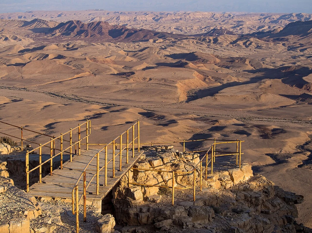
The Makhtesh Ramon is the world’s largest erosion crater, stretching 40 km long, 9 km wide, and plunging 400 meters deep. Unlike impact craters formed by meteorites or volcanic calderas formed by magma collapse, a makhtesh is formed purely through differential subterranean water erosion: soft sandstone strata beneath hard limestone caps are hollowed out by ancient river networks, causing the ceiling to collapse inward into a dramatic enclosed canyon.
Premier trekking routes in Makhtesh Ramon include:
- Mount Ardon Summit Trail: A demanding ridgeline ascent offering 360-degree panoramic vistas across the entire crater floor, showcasing multi-colored sandstone layers dating back 220 million years.
- Shen Ramon (Ramon’s Tooth): A steep scramble up a razor-sharp volcanic magmatic intrusion (dike) rising like a dark fang from the crater floor.
- The Carpentry Shop (HaMinsara): A unique geological formation where molten magma baked sandstone into thousands of symmetrical quartzite hexagonal prisms resembling stacked timber logs.
- Nahal Nekarot & Horseshoe Loop: A classic 14-km desert canyon loop winding through towering limestone narrows and ancient flash-flood water cisterns.
The Zin Valley & Ein Avdat Canyon
Carved by the massive Nahal Zin riverbed, the Ein Avdat National Park features a lush desert oasis canyon fed by perennial springs. Hikers ascend through towering white chalk cliffs via built-in steel ladders, passing natural freshwater pools, cascading waterfalls, and ancient desert poplar trees (Populus euphratica) that provide nesting sites for griffon vultures and desert eagles.
4. World-Class Scuba Diving & Marine Pursuits in the Red Sea
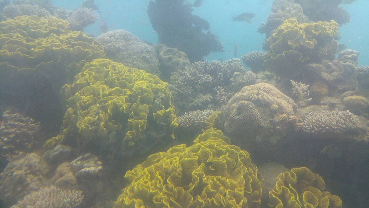
At the southernmost tip of Israel lies the city of Eilat on the Gulf of Aqaba (Red Sea). Positioned between the Sinai and Arabian peninsulas, this deep oceanic trench harbors the world’s northernmost shallow coral reef system. The crystal-clear waters boast year-round temperatures between 21°C and 26°C, underwater visibility exceeding 30 meters, and virtually no strong tidal currents, making it an international paradise for recreational scuba diving, freediving, and snorkeling.
Iconic Eilat Dive Sites
Eilat offers an extraordinary array of accessible shore dives and deep wreck explorations:
- The Coral Beach Nature Reserve: A strictly protected 1.2-kilometer fringing reef featuring vibrant coral gardens, schools of clownfish, butterflyfish, giant clams (Tridacna), and sea turtles. Well-marked underwater snorkeling trails allow non-divers to drift above the reef crest safely.
- The INS Satil (Missile Boat Wreck): Sunk deliberately in 1994 as an artificial reef, this 45-meter Saar 3-class Israeli naval missile ship rests perfectly upright at a depth of 24 meters. It is now heavily encrusted with soft corals and home to giant moray eels, lionfish, and barracudas.
- The Caves (HaMaarot): A shallow, scenic dive site featuring underwater swim-through tunnels packed with thousands of shimmering glassfish.
- Moses Rock & Joshua Rock: Massive coral pinnacles rising from 8 meters up to just below the surface, teeming with symbiotic cleaner shrimp, octopus, and Spanish dancers (nudibranchs).
- Dolphin Reef: An open-sea sanctuary where divers and snorkelers can interact in natural open waters with a resident pod of free-ranging bottlenose dolphins.
| Dive Site | Max Depth | Certification Required | Key Marine Life / Feature |
|---|---|---|---|
| Coral Beach Reserve | 6 m – 12 m | Snorkel / Open Water (OWD) | Fringing coral gardens, clownfish, giant tridacna clams. |
| INS Satil Missile Wreck | 24 m | Advanced Open Water (AOWD) | Upright military missile corvette, lionfish, giant moray eels. |
| The Japanese Gardens | 15 m – 40 m | OWD (Shallow) / AOWD (Deep) | Pristine sloping wall, massive table corals, eagle rays. |
| Sun Boat Wreck | 30 m | Advanced / Deep Diver | Sunken harbor tugboat, frogfish, deep schooling trevallies. |
5. Technical Canyoneering & Speleology in the Judean Desert
The Judean Desert drops precipitously from the Jerusalem plateau down to the Dead Sea basin—a staggering 1,200-meter elevation drop over just 25 kilometers. This steep geological fault line has carved hyper-dramatic limestone gorges featuring dry waterfall drop-offs that attract canyoneers and rappelling enthusiasts from around the globe.
Extreme Canyoneering: Nahal Darga & Nahal Kumran
For technical adventure seekers, the Judean Desert offers world-class canyoneering routes:
- Nahal Darga (The “Dredge”): Widely celebrated as Israel’s most exhilarating non-technical canyon hike. Adventurers navigate deep vertical slot canyons, scramble over massive boulders, and swim through natural rainwater-filled potholes carved deep into polished white limestone.
- Nahal Qumran & Nahal Tor (Technical Rappelling): Requiring full climbing harnesses, static ropes, and descenders, these canyons feature consecutive dry vertical drops up to 80 meters high, offering breathtaking views over the turquoise expanse of the Dead Sea.
Speleology: Malham Cave and Mount Sodom
Rising along the southwestern shore of the Dead Sea, Mount Sodom (Har Sedom) is an 11-kilometer-long mountain made almost entirely of pure rock salt (halite), capped with a thin layer of marl and gypsum. As rare desert flash floods dissolve vertical funnels through the salt mountain, a vast labyrinth of subterranean caverns has developed.
In 2019, an international speleological expedition led by the Hebrew University Cave Research Center officially mapped Malham Cave at over 10 kilometers of surveyed passages, officially dethroning Iran’s 3N Cave to become the longest salt cave in the world. Inside, spelunkers encounter towering salt stalactites, crystalline columns, and shimmering white salt walls resembling frozen underground glaciers.
6. Galilee & Golan Waterscapes: Northern River Trekking
In stark contrast to the arid south, northern Israel is an aquatic sanctuary nourished by the melting snowpack of Mount Hermon and subterranean karst springs. The region offers exhilarating “wet trekking” routes where hikers wade chest-deep through emerald mountain streams shaded by ancient plane trees and weeping willows.
| Northern Water Trail | Region | Water Depth / Route Type | Key Highlights |
|---|---|---|---|
| Nahal Snir (Hasbani) | Upper Galilee | Knee to waist deep / Wet hike | Rushing rapids, dense jungle-like canopy of Syrian ash trees. |
| Nahal Majrase (Beteiha) | Golan Delta | Chest deep to swimming / Wet trail | Estuary where five Golan streams meet the Sea of Galilee; great for families. |
| Nahal Meshushim Pool | Central Golan | Dry canyon descent to deep freshwater pool | Surrounded by hundreds of dramatic geometric hexagonal basalt columns. |
| Nahal Kziv & Montfort | Western Galilee | Ankle deep wading / Shaded valley | Perennial spring pools overlooked by the towering Crusader fortress of Montfort. |
7. World-Class Rock Climbing & Bouldering Crags
Israel’s complex geomorphology provides a thrilling playground for sport climbers, traditional trad climbers, and boulderers. The climbing scene in Israel has expanded rapidly, supported by the Israel Climbers Club (ICC) and strict ecological crag maintenance agreements with the INPA.
Premier Sport Climbing Crags
- Gita Crag (Western Galilee): A premier limestone cliffline perched above Nahal Beit HaEmek, featuring over 150 bolted sport routes ranging from beginner 5b slabs to technical 8a+ crimpy overhangs. Climbing here during winter and spring offers cool mountain breezes and vistas stretching to the Mediterranean Sea.
- Nezer Cave (Shira Cave): An enormous arched karst limestone roof in the Western Galilee, renowned globally as Israel’s ultimate hard-sport climbing destination, with steep roof routes graded up to 9a.
- Ein Prat / Nahal Prat (Wadi Qelt): Located in the northern Judean Desert near Jerusalem, Ein Prat features towering vertical limestone walls rising directly above turquoise spring pools. It is the birthplace of Israeli rock climbing, offering both single-pitch sport lines and traditional multi-pitch trad routes.
- Timna Park & Eilat Red Rocks: In the south, climbers tackle ancient pre-Cambrian red granite towers and textured sandstone monoliths, offering world-class bouldering blocks and desert trad adventures.
8. Mediterranean Marine Sports, Sea Caves & Surfing
With 273 kilometers of Mediterranean coastline, Israel boasts a deep-rooted ocean culture that has produced Olympic champions and a thriving coastal lifestyle.
Rosh HaNikra Sea Kayaking & Subterranean Grottoes
At the northernmost tip of Israel’s Mediterranean coast lies Rosh HaNikra, where towering sheer white chalk cliffs plunge dramatically into the azure sea. Sea kayakers launch from Achziv Beach to paddle along the cliff base and navigate through luminous subterranean marine grottoes hollowed out by centuries of wave action, encountering sea turtles and bioluminescent waters.
Haifa’s Bat Galim: The Windsurfing & Kitesurfing Mecca
Haifa’s Bat Galim Beach is internationally famous among extreme windsurfers and kitesurfers. Positioned at the hook of Haifa Bay where the Carmel mountain ridge meets the sea, Bat Galim generates powerful thermal westerly sea breezes in the summer and massive winter storm swells. When deep low-pressure systems sweep across the eastern Mediterranean between November and March, Bat Galim produces world-class 3- to 5-meter barreling waves with howling 35-knot winds, drawing international Red Bull storm riders.
The Olympic Sailing Cradle at Sdot Yam
The waters off Kibbutz Sdot Yam and Caesarea serve as Israel’s elite nautical training ground. Israel has achieved extraordinary global success in windsurfing and dinghy sailing, capturing multiple Olympic medals—including Olympic gold by Gal Fridman (Athens 2004) and Tom Reuveny (Paris 2024), and silver by Sharon Kantor (Paris 2024). State-of-the-art sailing clubs along the coast offer dinghy rentals, catamarans, and wind foiling courses for watermen of all levels.
Tel Aviv Urban Surf Culture
Surfing in Israel was pioneered in the 1950s by legendary American surfer Dorian Paskowitz, who brought the first fiberglass surfboards to Tel Aviv. Today, Tel Aviv’s beaches (especially Hilton Beach, Maravi, and the Dolphinarium Break) feature an energetic dawn-patrol surf culture, with local shapers, surf schools, and board rentals operating year-round.
9. Regional Long-Distance Trails: The Golan Trail & Jesus Trail
Beyond the national trail, Israel features specialized regional long-distance routes catering to distinct historical and landscape interests:
The Golan Trail (Shvil HaGolan)
Spanning 120 kilometers (75 miles) across the volcanic basalt plateau of the Golan Heights, the Golan Trail runs from Mount Hermon in the north to Kibbutz HaOn on the southern shores of the Sea of Galilee. Divided into 15 manageable day stages, the trail crosses cinder cones (volcanic mounds), wild oak savannas, seasonal spring pools, and dramatic canyon overlooks into the Syrian and Jordanian borders.
The Jesus Trail & Gospel Trail
Connecting key spiritual and historical sites across the Galilee, the Jesus Trail (65 km) and the parallel Gospel Trail (62 km) lead hikers from Nazareth through Zippori National Park, Cana, the Horns of Hattin, and the Arbel Cliff down to Capernaum on the Sea of Galilee. These trails provide an intimate walking journey through peaceful olive orchards, Druze villages, and ancient Byzantine ruins.
10. Astro-Tourism: International Dark Sky Park at Makhtesh Ramon
With minimal urban light pollution across the high central Negev plateau, Makhtesh Ramon was officially designated the Middle East’s first International Dark Sky Park by the International Dark-Sky Association (IDA). The pristine night sky offers astronomical clarity, making the edge of the crater in Mitzpe Ramon a global hub for stargazers, astrophotographers, and deep-space observation.
Every August, thousands of travelers gather on the crater rim for the annual Perseid Meteor Shower, when the municipality dims all streetlights to ensure uncompromised visibility of hundreds of shooting stars blazing across the Milky Way.
11. Endurance Athletics, Trail Running & Ultramarathons
Israel’s rugged topography has fostered an energetic endurance sports culture, hosting world-renowned trail races and marathons:
- The Dead Sea Marathon: Recognized as the lowest marathon on Earth (-430 meters below sea level), runners course along dirt embankments extending directly into the crystal-turquoise salt pans of the southern Dead Sea.
- Eilat Desert Marathon: A dramatic off-road trail race combining arid mountain ridgelines, Red Canyon trails, and a coastal finish along the Red Sea.
- Sovev Emek Ultramarathon: Staged across the rolling oak forests of the Megiddo Biosphere Reserve, drawing international ultra-runners for 50 km, 100 km, and 100-mile mountain foot races.
- Sea of Galilee Tiberias Marathon: One of the world’s oldest continuous marathon races, tracing the scenic, flat shoreline perimeter of Lake Kinneret.
12. The Global Avian Flyway: Birdwatching in the Rift Valley
Israel is universally recognized by ornithologists as one of the top three birdwatching destinations on the planet. Positioned as a narrow geographical land bridge connecting Eurasia with sub-Saharan Africa, over 500 million migratory birds cross Israeli skies twice every year during the autumn and spring migrations.
Agamon HaHula: The Wetland Miracle
In the northern Hula Valley, the Agamon HaHula Nature Reserve stands as the centerpiece of Levant birding. Over 40,000 common cranes (Grus grus) spend the entire winter in the restored peat wetlands, accompanied by tens of thousands of pelicans, white storks, flamingos, and endangered raptors like the greater spotted eagle and imperial eagle.
The reserve features specialized mobile bird-hiding wagons pulled by agricultural tractors, allowing birdwatchers and wildlife photographers to approach within meters of foraging crane flocks without causing disturbance.
Eilat & Arava Raptor Watchpoints
In spring, the skies over the Eilat Mountains become the premier venue for witnessing mass raptor migrations. Thermals rising from the desert floor carry hundreds of thousands of honey buzzards, Levant sparrowhawks, and steppe eagles as they cross from the Sinai Peninsula into the Levant corridor.
13. Mountain Biking & Singletrack Networks
Over the past two decades, the Jewish National Fund (KKL-JNF) and the Israel Bike Trail Authority have invested millions in engineering over 1,500 kilometers of dedicated, flowing singletrack mountain bike trails. These sustainably designed bermed trails are mapped with GPS accuracy and color-coded by technical difficulty.
- Ben Shemen Forest Singletrack: The beating heart of central Israeli MTB culture, featuring 60+ km of interconnected flow trails, rock gardens, and bermed switchbacks through pine woods.
- The Sugar Trail (Negev to Dead Sea): A legendary 20-km desert freeride descent following an ancient camel trade route from Ma’ale Adumim down to the Dead Sea basin, dropping over 1,000 vertical meters through chalky lunar ridgelines.
- Timna Park Singletrack: A sweeping 14-km desert loop winding between towering crimson sandstone pillars, ancient Egyptian copper mines, and King Solomon’s Pillars.
- Misgav Singletrack: A technical, rock-strewn playground nestled in the Galilee oak forests, renowned for steep natural drops and technical line choices.
14. Desert Eco-Lodges, Glamping & Traditional Khans
Outdoor accommodation across Israel blends authentic wilderness immersion with sustainable architecture. Adventurers can choose between diverse hospitality experiences:
- Traditional Desert Khans (e.g. Kfar HaNokdim, Khan Be’erot): Sprawling Bedouin-style hospitality complexes featuring communal felt tents, central fire pits, traditional campfire tea and coffee, and direct access to desert hiking trails.
- Sustainable Eco-Kibbutzim (e.g. Kibbutz Lotan, Neot Semadar): Hand-sculpted adobe straw-bale guest domes, organic date orchards, solar-powered facilities, and permaculture workshops nestled in the Arava Desert.
- Luxury Desert Glamping: High-end eco-resorts overlooking Makhtesh Ramon and the Arava Valley cliffs, offering private stargazing terraces and climate-controlled canvas lodges.
15. Trail Navigation Tools, Parks Passes & Cartography
Navigating Israel’s extensive outdoor trails requires accurate modern cartography and local knowledge. Hikers rely on high-precision open-source topographic tools like the Israel Hiking Map (IHM) and Amud Anan, which provide crowdsourced field notes on natural springs, shade spots, cistern water levels, and cave entrances in real time.
For extensive travelers, purchasing the INPA Matmon National Parks Pass grants unlimited year-round admission to over 60 premier nature reserves and archaeological landmarks across the country—including Masada, Caesarea, Beit Guvrin, Ein Gedi, and the Hermon stream—while directly funding national trail conservation, mountain rescue operations, and ecological biodiversity research.
Navigation across Israel’s extensive trail network is facilitated by standardized topographic cartography and digital GPS ecosystems:
- The INPA Matmon Parks Card: For avid outdoor enthusiasts exploring multiple national reserves and archaeological monuments, the Israel Nature and Parks Authority offers the annual Matmon Card or discounted tourist multi-passes granting unlimited entry to over 60 managed sites nationwide.
- SPNI 1:50,000 Topographic Trail Maps (Simun Shvilim): A series of 20 detailed maps produced by the SPNI covering the entire country, showing all officially marked trails, water points, historical ruins, and elevation contours.
- Digital Navigation Apps: Community GIS applications like Israel Hiking Map (IHM), Amud Anan, and Trailze provide real-time offline GPS tracking, crowd-sourced water point statuses, and user notes on trail conditions.
16. Essential Desert Safety & Environmental Stewardship Protocols
While outdoor pursuits in Israel are immensely rewarding, the desert environment demands thorough preparation, physical respect, and situational awareness.
Flash Flood Awareness (The “Shitafon” Hazard)
The single greatest natural hazard in the Negev and Judean Deserts is the flash flood (Shitafon). Because desert soils are hard-baked and barren, sudden rainfall occurring dozens of kilometers upstream in the Judean or Hebron Hills cannot penetrate the ground. Instead, the water gathers into violent, fast-moving walls of muddy torrents that rush down narrow desert canyons (wadis) under clear blue skies.
Safety Rules for Flash Floods:
- Never enter narrow desert canyons or dry riverbeds when flash flood warnings are active.
- Always check real-time radar forecasts from the Israel Meteorological Service (IMS) before embarking on desert canyon routes.
- If you hear a deep rumbling sound like an approaching freight train or notice a sudden increase in dust and water vapor downstream, immediately climb the nearest canyon wall to high ground.
Hydration, Thermal Management & Leave No Trace
- Water Requirements: In desert terrain, carry a minimum of 4 to 5 liters of water per person per day (increasing to 6 liters during warmer months). Do not rely on natural desert springs, which may dry up seasonally or be reserved for local wildlife.
- Sun Protection: Wear wide-brimmed hats, UV-blocking breathable clothing, and polarized sunglasses to protect against high desert albedo.
- Leave No Trace (LNT): Camp only in designated overnight campgrounds (Chanyon Layla) to prevent habitat destruction and avoid disturbing nocturnal desert wildlife. Pack out all trash and bury human waste at least 15 cm deep and 50 meters away from watercourses.
17. Frequently Asked Questions (FAQ)
How long does it take to hike the entire Israel National Trail?
Thru-hiking the 1,050 km Israel National Trail typically takes between 45 and 60 days. It can also be broken down into individual day hikes or multi-day regional segments.
What is the best season for hiking and outdoor pursuits in Israel?
Autumn (October to December) and Spring (February to April) offer ideal trekking temperatures nationwide. Winter is perfect for desert hiking in the Negev and skiing on Mount Hermon, while summer is best suited for water trekking in the Galilee and scuba diving in Eilat.
Who are the “Trail Angels” (Malachei HaShvil)?
Trail Angels are volunteer Israeli residents living near the Israel National Trail who host thru-hikers in their homes, providing free sleeping spaces, hot meals, showers, and water caches along remote desert legs.
Is scuba diving in the Red Sea at Eilat suitable for beginners?
Yes. Eilat features calm waters, warm sea temperatures, minimal current, and protected shallow fringing reefs (like Coral Beach), making it one of the most accessible and safe locations globally for beginner scuba certification and introductory dives.
What is the world record held by Malham Cave at Mount Sodom?
Malham Cave is officially certified as the world’s longest salt cave, featuring over 10 kilometers of mapped subterranean passages carved through pure halite rock salt beneath Mount Sodom next to the Dead Sea.